MSU Storm Chase Class

Thursday, August 6, 2009

Hurricanes and El Nino


A developing El Nino pattern has caused forecasters at the Climate Prediction Center and National Hurricane Center to pull back a bit on the number of named storms forecast in the Atlantic basin this season.

El Nino is warming of the equatorial waters of the Pacific to much above normal conditions. It usually starts in the eastern Pacific as the NOAA animation above shows. The warming of the waters helps to generate thunderstorms which in turn transport heat into the upper atmosphere. This strengthens the jet stream over the Atlantic equatorial regions. Strong jet stream winds, or more precisely the shear they produce, tear apart developing tropical systems. It’s ironic that powerful storms like Katrina actually require benign conditions in which to first start developing!

A complete write-up on this topic from NOAA can be found here.


Ted Keller
Senior Meteorologist
KOLR/KSFX-TV
Storm chasing and more at:
Ceaseless Wind

Wednesday, August 5, 2009

Hot Weekend


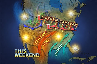
This weekend will see that hottest weather since our heat wave back in late June. Middle nineties will be common along with high humidity. This will mean the Heat Index will be at or over 100 during this period. The pattern breaks ever so slightly early next week as another weak front tries to drop through the Ozarks.


Ted Keller
Senior Meteorologist
KOLR/KSFX-TV
Storm chasing and more at:
Ceaseless Wind

Hurricane Stats


There has been some question about how many tropical storms and hurricanes should have shown up by now over the Atlantic Basin. It should be pointed out that in recent years, the season has been starting a tad early. The stats show August shows a rapid increase in the number of storms. The real season for hurricanes kicks in in late August and peaks around September 10th.

August has seen some powerful storms including Andrew, Camille and Katrina.


Ted Keller
Senior Meteorologist
KOLR/KSFX-TV
Storm chasing and more at:
Ceaseless Wind
Tuesday, August 4, 2009

Storm Update 10 pm 8/4/09


Storms are firing to the southeast of Springfield tonight. The radar shot is from shortly after 10 pm. These and other new storms will continue to move southeast overnight. The storms may build westward a bit more during this time. Some severe weather is possible with these storms along and south of a line from Forsyth to Eminence, MO.


Ted Keller
Senior Meteorologist
KOLR/KSFX-TV
Storm chasing and more at:
Ceaseless Wind

Severe Storm Outlook Fore This Afternoon and Evening


SPC Mesoscale Discussion;

"A PRE-FRONTAL LOWER/MID TROPOSPHERIC THERMAL RIDGE IS GRADUALLY
BECOMING SUPPRESSED SOUTHWARD ACROSS PARTS OF THE MID MISSISSIPPI/
LOWER OHIO VALLEY REGION...TO THE SOUTH OF THE COLD UPPER TROUGH
ACROSS CENTRAL CANADA AND THE UPPER GREAT LAKES REGION. AS THIS
OCCURS...DESTABILIZATION AND FORCING ALONG THIS FEATURE APPEARS
LIKELY TO BECOME THE FOCUS FOR INCREASING/INTENSIFYING CONVECTIVE
DEVELOPMENT FROM SOUTHERN MISSOURI INTO THE KENTUCKY/TENNESSEE
BORDER AREA...WHERE MERGING/CONSOLIDATING STORMS WILL CONTRIBUTE TO
ONE EXPANDING STORM CLUSTER IN THE PRESENCE OF MODERATE TO STRONG
POTENTIAL INSTABILITY. FORCING ASSOCIATED WITH WESTERN PORTION OF
LOW AMPLITUDE TROUGH SHIFTING WITHIN BROADER SCALE CYCLONIC FLOW
ACROSS THE REGION MAY SUPPORT ANOTHER GROWING STORM CLUSTER ACROSS
SOUTHEAST MISSOURI INTO WESTERN KENTUCKY. AS THIS OCCURS...AND
ASSOCIATED SURFACE COLD POOLS DEVELOP/STRENGTHEN MOMENTUM/SHEAR
ASSOCIATED WITH A 30-50 KT WESTERLY 500 MB SPEED MAXIMUM WILL
PROBABLY EVENTUALLY CONTRIBUTE TO INCREASING DAMAGING WIND POTENTIAL
BY EARLY EVENING. UNTIL THIS OCCURS...THE RISK FOR FREQUENT CLOUD
TO GROUND LIGHTNING AND LARGE HAIL WILL EXIST...ALONG WITH A GRADUAL
INCREASE IN POTENTIAL FOR HEAVY RAINFALL AS STORMS BEGIN TO TRAIN.""


Ted Keller
Senior Meteorologist
KOLR/KSFX-TV
Storm chasing and more at:
Ceaseless Wind

Storm Update 2:30 pm 8/4/09


All calculations based on radar at 2:30 pm.

A line of strong to severe thunderstorms will be descending SE through Dade, Polk and Dallas county over the next hour. The line will be in northern Greene County at about 3:30 and in the Springfield city between 3:30 and 4:00 pm. Watch out for damaging wind and hail with some of these storms.


Ted Keller
Senior Meteorologist
KOLR/KSFX-TV
Storm chasing and more at:
Ceaseless Wind

The severe weather outlook for today was updated slightly to include more of the Ozarks farther south. Outflows from rain and storms to the north of the viewing area earlier today may be the focus for thunderstorm development later this afternoon. The primary threat should be some locally damaging winds and small hail.


Ted Keller
Senior Meteorologist
KOLR/KSFX-TV
Storm chasing and more at:
Ceaseless Wind