MSU Storm Chase Class

Monday, August 10, 2009

6-10 Day Forecast


The period Sunday through Thursday of next week appears to be close to normal for temperature and rainfall in the Ozarks. An upper level low pressure area looks like it will establish itself over the western U.S., spreading cooler-than-normal air in the Great Plains. The Ozarks is on the extreme eastern end of this region. Rainfall will be maximized on the eastern side of the flow around the western low pressure system.

View all Climate Prediction Center extended forecasts.

Ted Keller
Senior Meteorologist
KOLR/KSFX-TV
Storm chasing and more at:
Ceaseless Wind

Storm Update 4:30 pm 8/10/09


The line of storms has fragmented a bit since earlier this afternoon and does not at this time represent a traditional bowing segment of storms with its accompanying widespread wind damage. However, it will still have some severe winds in connection with some of the stronger storms. Of larger concern is the additional rainfall that areas north of Springfield are now receiving and that the metro area will get beginning at about 5:15 and lasting through 6:45. Greene County and some of the surrounding area is presently under a flash flood warning.


Ted Keller
Senior Meteorologist
KOLR/KSFX-TV
Storm chasing and more at:
Ceaseless Wind

Severe Update August 10th 2:35 pm


An active bow echo which has caused wind damage in Kansas will cross into the northern portion of the viewing area this afternoon and early evening. A severe thunderstorm watch was issued for areas north of Springfield as a result of this advancing line. Folks north of a line from Lamar to Salem, MO need to be on the lookout for damaging wind as this line advances at about 40 mph.

This will affect the Truman Lake area starting at 3:30 and the Lake of the Ozarks starting at about 4:30 pm.

You can watch this line advance using interactive radar on Ozarksfirst.com


Ted Keller
Senior Meteorologist
KOLR/KSFX-TV
Storm chasing and more at:
Ceaseless Wind

Thursday, August 6, 2009

Hurricanes and El Nino


A developing El Nino pattern has caused forecasters at the Climate Prediction Center and National Hurricane Center to pull back a bit on the number of named storms forecast in the Atlantic basin this season.

El Nino is warming of the equatorial waters of the Pacific to much above normal conditions. It usually starts in the eastern Pacific as the NOAA animation above shows. The warming of the waters helps to generate thunderstorms which in turn transport heat into the upper atmosphere. This strengthens the jet stream over the Atlantic equatorial regions. Strong jet stream winds, or more precisely the shear they produce, tear apart developing tropical systems. It’s ironic that powerful storms like Katrina actually require benign conditions in which to first start developing!

A complete write-up on this topic from NOAA can be found here.


Ted Keller
Senior Meteorologist
KOLR/KSFX-TV
Storm chasing and more at:
Ceaseless Wind

Wednesday, August 5, 2009

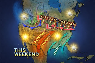
Hot Weekend


This weekend will see that hottest weather since our heat wave back in late June. Middle nineties will be common along with high humidity. This will mean the Heat Index will be at or over 100 during this period. The pattern breaks ever so slightly early next week as another weak front tries to drop through the Ozarks.


Ted Keller
Senior Meteorologist
KOLR/KSFX-TV
Storm chasing and more at:
Ceaseless Wind

Hurricane Stats


There has been some question about how many tropical storms and hurricanes should have shown up by now over the Atlantic Basin. It should be pointed out that in recent years, the season has been starting a tad early. The stats show August shows a rapid increase in the number of storms. The real season for hurricanes kicks in in late August and peaks around September 10th.

August has seen some powerful storms including Andrew, Camille and Katrina.


Ted Keller
Senior Meteorologist
KOLR/KSFX-TV
Storm chasing and more at:
Ceaseless Wind
Tuesday, August 4, 2009

Storm Update 10 pm 8/4/09


Storms are firing to the southeast of Springfield tonight. The radar shot is from shortly after 10 pm. These and other new storms will continue to move southeast overnight. The storms may build westward a bit more during this time. Some severe weather is possible with these storms along and south of a line from Forsyth to Eminence, MO.


Ted Keller
Senior Meteorologist
KOLR/KSFX-TV
Storm chasing and more at:
Ceaseless Wind