MSU Storm Chase Class

Sunday, August 23, 2009

Our Delightful Weekend!

Wow, this weekend won't soon be forgotten! Plenty of sun, warm but not hot, very low humidity and even a breeze on Saturday combined to make our of the last weekends of summer a great one.

Our low temperature Saturday monring was 55 degrees. The record for this date was 50. The high on Saturday only reached 77 degrees officially at the airport.

Sunday started out cool again dropping down to 54 degrees. It looks unlikely we will crack 80 this afternoon once again!

The trend will be for temperatures to continue to slowly climb this week before another cool front ensures our below normal trends continue.

The official Climate Prediction Center forecasts keep us trending cool through early September.


Ted Keller
Senior Meteorologist
KOLR/KSFX-TV
Storm chasing and more at:
Ceaseless Wind

Friday, August 21, 2009

Bill Information


Ted Keller
Senior Meteorologist
KOLR/KSFX-TV
Storm chasing and more at:
Ceaseless Wind

Thursday, August 20, 2009

Leaning Toward Cool and Wet Still


As the last days of August and summer come to a close, long range forecasts out to 10days (even 14 days) are pointing toward a continuation of the cooler and wetter trends of late. This pattern has been with us, with few interruptions, since the beginning of July. It is the result of a flow at the jet stream level which has been out of the northwest allowing cool fronts to slip southward at regular intervals. By my count, we have had nearly twenty "FROPA"'s (FROntal PAssages) since June 1st. Would you like to try counting these? Go to: http://www.hpc.ncep.noaa.gov/dailywxmap/

A pattern like this could also be cool and dry but the timing between fronts and the exact trajectory of the jet is allowing moisture and instability to build ahead of these systems and hence showers and storms can more easily develop. A review of the storms and rain of August 19/20 can be found here. If this pattern were more "amplified" (more north to south), we would still get the cool (likely even cooler) but the fronts would probably pass through "dry".

Ted Keller
Senior Meteorologist
KOLR/KSFX-TV
Storm chasing and more at:
Ceaseless Wind

Storm Summary August 19/20, 2009


A tornado watch is August? Not too common. Chalk it up to the 2009 “summer of cool fronts” pattern. With a pattern like this, we are bound to get rain and severe weather. Last night, the Ozarks were treated to both. A map examining radar estimated rainfall shows common 2-4″ totals in a swath from southeastern Kansas southeastward to Barry County and including the Joplin/Carthage area. This area was hit repeatedly by rain and storms Wednesday and Wednesday night. Other areas receiving 1.5 inches of rain or greater include portions of Dallas, Laclede, Pulaski, Phelps, Texas, Dent, Shannon, Howell and Douglas Counties.

There were also widespread reports of severe or sub-severe wind gusts. The NWS confirms that an EF1 tornado caused the destruction of a mobile home north of Roby resulting in one injury. There were numerous wall cloud and funnel reports in McDonald, Newton and Barry county as well.

Ted Keller
Senior Meteorologist
KOLR/KSFX-TV
Storm chasing and more at:
Ceaseless Wind

Wednesday, August 19, 2009

Tornado Warning for Newton and McDonald Counties


Newest tornado warning will affect Neosho within the next 30 minutes and might just threaten western Barry including Monett, Purdy and Cassville by midnight.

Ted Keller
Senior Meteorologist
KOLR/KSFX-TV
Storm chasing and more at:
Ceaseless Wind

Severe Update


It is possible for an extention of the tornado warning into northwestern Greene and southern Polk.

Ted Keller
Senior Meteorologist
KOLR/KSFX-TV
Storm chasing and more at:
Ceaseless Wind

Severe Weather Update


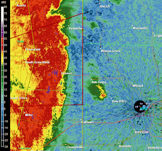
Line segment is bowing and will likely produce 70 mph winds from Joplin to Lamar over the next 45 minutes.

Ted Keller
Senior Meteorologist
KOLR/KSFX-TV
Storm chasing and more at:
Ceaseless Wind