MSU Storm Chase Class

Saturday, September 26, 2009

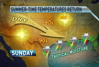
SUMMER-LIKE SUNDAY


Temperatures rise above normal on Sunday, with highs in the lower to middle 80s. Normal highs are in the upper 70s this time of year. Southwest winds increase ahead of an approaching cold front tomorrow, which will advect the summer-like air mass northward. The cold front is set to pass through at night and bring fall readings to the Ozarks early in the week.

A BIG COOL DOWN IS COMING...

A dry cold front is forecast to pass through on Sunday night and bring the coldest air of the season so far. Highs will struggle to rise into the 70s on Monday. Lows in the lower 40s are a good possibility by Tuesday morning, which is the coldest air we've experienced since the middle of May. The below normal air mass will only linger for a couple of days before we warm back up again.

Monday, September 21, 2009

Heavy Rain Tonight


A slow moving front will continue to drop in some cases inches of rain on the Ozarks through tonight. The areas which will receive the most are portions of Greene, Lawrence, Barry, Jasper, Newton and McDonald Counties in Missouri and Benton and Washington Counties in northwest Arkansas where over 3" could fall locally.

Ted Keller
Senior Meteorologist
KOLR/KSFX-TV
Storm chasing and more at:
Ceaseless Wind

Sunday, September 20, 2009

STRONG STORM SYSTEM EARLY IN THE WEEK

The jetstream digging southward across the Midwest sends a strong cold front our way. The right atmospheric conditions will come together causing severe storms to develop late on Monday. The primary threats are damaging winds, large hail and flooding rains. The western Ozarks stand the greatest chance of experiencing severe weather. Areas to the east of highway 65 will mainly deal with weaking storms and heavy rainfall late on Monday night and into Tuesday morning.
Here is a general rainfall forecast for Monday night through Tuesday night. Locally higher amounts will definitely be possible. The heaviest rain is forecast to fall across an area that has already seens several inches of rain. Flash flooding is a definite concern and a watch may be issued later in time from the National Weather Service.

Saturday, September 19, 2009

SATURDAY'S BLOB OF RAIN

This is the radar image as of 12:35 pm on Saturday. A blob of rain with isolated storms is tracking northwestward at 30 mph. The heaviest rain is concentrated southeast of I-44. A flash flood warning is in effect until 5pm across southern Ozark, northern Marion and northern Baxter county. Radar estimates are greater than 2" across MO/AR border, which has fallen since 8 am. Be careful when driving today across the warned area because runoff from the heavy rainfall will cause flooding of small streams, creeks, county roads as well as farmland.

STRONG FRONT ARRIVES ON MONDAY-TUESDAY

A strong cold front approaches the Ozarks on Monday. The image above is the frontal position forecast for Monday morning.
There is a slight risk for severe storms on Monday afternoon and evening across western Missouri. The main risks are damaging winds and hail.
The front is expected to produce heavy rainfall which could lead to flash flooding. The image above shows the amount of rain forecast to fall from now until Tuesday morning. Heavy rain along the front will start impacting our western counties on Monday afternoon and evening and then slowly spread eastward with time. H.P.C. is forecasting 1-2" of rain with locally higher amounts.

Friday, September 18, 2009

Cooler Air on the Way.


The cool front responsible for the storms and rain Monday will move through. Another "cut-off" low in the upper atmosphere is expected to form midweek. This will keep us cool and fairly cloudy post-front. There is a chance for forty-degree lows with this latest shot of cool air.


Ted Keller
Senior Meteorologist
KOLR/KSFX-TV
Storm chasing and more at:
Ceaseless Wind