MSU Storm Chase Class

Tuesday, May 5, 2009

Active Spring Weather Next Week

The average jet stream flow over the next seven days features a fast flow over a tight belt in the central U.S. Frequent disturbances moving through this flow will ensure regular rain chances but also shots at severe weather.

This type of pattern produces clusters of storms (MCS's - Mesoscale Convective Systems) which travel along and slightly south of the average jet stream flow. Missouri and Arkansas are in, or on the northern end of, this zone!

This link loops through the 500 mb (about 18,000) flow. The wind roughly flows along the lines from west to east:

http://www.hpc.ncep.noaa.gov/medr/day3-7diff_500ensloop.html

Beyond Wednesday, it looks as if a deeper storm may develop out west which would be of concern to us too if it develops.

SMILE (strict model interpretation laughable or eventful) is always in effect of course!

Sunday, May 3, 2009

May 4, 2003 Tornado Outbreak Anniversary

For a detailed look at that day visit: www.crh.noaa.gov/sgf/Events/2003/may4/
Another review along with radar loops and videos can be found at http://ceaselesswind.com/tedstornado.html

More Rain This Week...

We'll catch a break from the rain on Monday and see the chance for rain and storms return on Tuesday.
Climate Data: Precipitation
1.76" above normal for the month of May
4.27" above normal for the year

Saturday, May 2, 2009

UPDATE TO FLOOD POTENTIAL


The front stalled out further southward across Arkansas which means less rain for the Ozarks than previously thought. The flash flood watch was trimmed down this afternoon and may be trimmed even further by tonight. The heaviest rain is forecast to fall across Arkansas tonight. The rainfall forecast map is general and localized areas may receive more than what is predicted.

Thursday, April 30, 2009

FLASH FLOODING CONCERNS


Periods of heavy rain is expected through the weekend which could lead to flash flooding. A cold front is forecast to stall out across southern Missouri by tomorrow night. Disturbances will interact with the front and cause rain and storms to develop. Any additional rain falling on saturated soils could easily result in flash flooding and river flooding.

Wednesday, April 29, 2009

SEVERE WEATHER THREAT

Besides heavy rainfall, there is a threat for severe storms on Friday. Gulf moisture will interact with slow moving or stalling front, causing strong to severe storms to develop late in the day. Forcing will increase at night, as the low level jet kicks in. Large hail and perhaps gusty winds may accompany the storm clusters that evolve across Ozarks. The tornado threat will be greatest across SW Oklahoma and W. Texas during the afternoon hours, due to veering winds in that location. Southwesterly winds are expected locally which is not condusive for rotating thunderstorms.

Tuesday, April 28, 2009

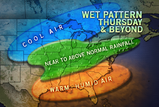
Wet Weather Pattern

There's the potential for 5" of rain to fall over the next 5 days.
Several rounds of heavy rain are expected through early next week. Flooding and flash flooding is going to be a big concern.